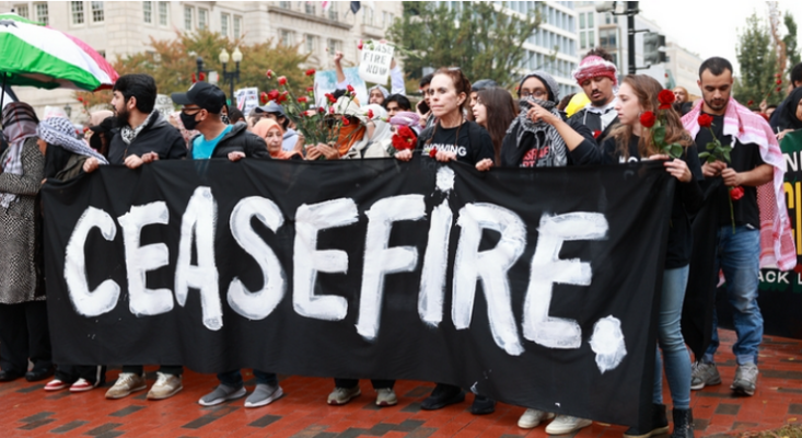


 1 comment

Pasadena Fire Chief Chad Augustin will present the City of Pasadena’s Citywide Evacuation Plan before the Public Safety Committee which meets on Wednesday starting at 4 p.m.
The Evacuation Plan identifies three hazards as “high risk” for Pasadena: wildfires (especially the wildfire urban interface), floods (including wind-driven water), and hazardous materials release.
The report also cites climate change increasing both the likelihood and consequences of wildfires and floods.
“Climate change has driven an increase in wildfires, particularly by drying forests and making them more susceptible to burning. Climate models project an increase in the frequency of heavy downpours, especially through atmospheric rivers, which are narrow bands of highly concentrated storms that move in from the Pacific Ocean,” the report said.
The plan also identifies the system of response that the City currently applies in responding to any type of disaster that can impact Pasadena, and points to five “evacuation zones” in the City as well as the transportation routes available to each of these zones during an actual evacuation.
The Pasadena Evacuation Plan is a result of collaborative partnerships and an ongoing commitment to excellence in emergency management. The Pasadena Fire Department initiated the project supported by local area city departments.
Numerous agencies and organizations provided input and members of a Steering Committee organized for the purpose of providing strategic guidance regarding plan development and implementation provided support.
The plan is intended to streamline the evacuation process by providing an organized framework for coordinating and conducting an evacuation to move people to a safe area when emergency situations required such an action. It is also designed to help the city coordinate its response and collaborate with federal, state, and other municipal governments, as well as non-governmental organizations.
The Fire Department said the Pasadena Evacuation Plan, which consists of over 80 pages including appendices, does not replace the need for existing Emergency Operations Center procedures and associated Emergency Operation Plans.
Fire Chief Augustin is expected to explain the plan in depth before the Public Services Committee during Wednesday’s meeting.
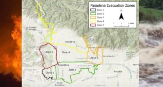
Pasadena is organized into five different zones based on evacuation risk. Higher risk areas near the Arroyo and Hastings Ranch received their own zones to ensure people can evacuate safely, a report by the Fire Department said.
Zone 1 encompasses the South Arroyo area with a black boundary (see picture above); Zone 2 includes downtown Pasadena and parts of the city below the 210 with a green boundary. Zone 3 includes the Hastings Ranch area and parts of Eastern Pasadena with an orange boundary.
Zone 4 encompasses parts of the city that are above the 210 freeway and includes where the city boundaries head north with a gold boundary. Zone 5 contains the North Arroyo area including the Rose Bowl with a red boundary.
The main evacuation routes will be the 210 freeway and the 110 freeway. Avenues and boulevards will be used to alleviate traffic in case of emergencies.
Highways 210 and 134 will be used to send people to neighboring cities, the report added.
 Get our daily Pasadena newspaper in your email box. Free.
Get all the latest Pasadena news, more than 10 fresh stories daily, 7 days a week at 7 a.m.