


 0 comments
A satellite scheduled to lift-off in November will carry a new gadget built by the Jet Propulsion Laboratory that will take precise measurements of global temperatures and humidity levels at every level of the atmosphere with the ultimate goal of improving weather forecasts, JPL announced Friday.
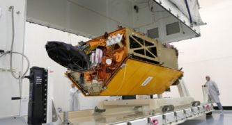
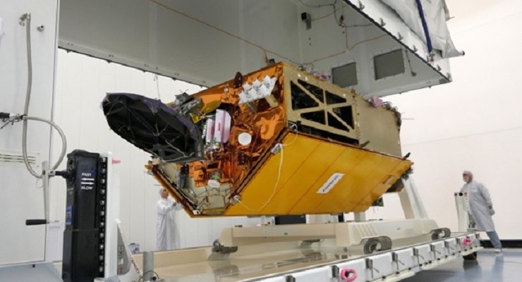
JPL’s Global Navigation Satellite System — Radio Occultation instrument, or GNSS-RO, will hitch a ride to orbit on the Sentinel-6 Michael Freilich satellite, which is a collaboration between NASA and the European Space Agency with the primary mission of tracking global sea levels, JPL said in a written statement.
“Our fundamental goal with Sentinel-6 is to measure the oceans, but the more value we can add, the better,” JPL Mission Project Scientist Josh Willis said. “It’s not every day that we get to launch a satellite, so collecting more useful data about our oceans and atmosphere is a bonus.”
The GNSS-RO instrument collects its measurements by examining radio signals emanated by navigation satellites, according to JPL.
“As a radio signal passes through the atmosphere, it slows, its frequency changes, and its path bends,” the statement said. “Called refraction, this effect can be used by scientists to measure minute changes in atmospheric physical properties, such as density, temperature, and moisture content.”
National Weather Service meteorologists plan to use information gleaned from the instrument to improve their forecasts, and the data will also be used to help make long-term climate predictions.
“Data from this mission will help track the formation of hurricanes and support models to predict the direction storms may travel,’ the JPL statement said. “The more data we gather about hurricane formation and where a storm might make landfall, the better in terms of helping local efforts to mitigate damage and support evacuation plans.”
Sentinel-6 has a twin satellite, Sentinel-6B, which is expected to launch in 2025 to take over for its younger sibling.
“Once in orbit, each Sentinel-6 satellite will collect sea level measurements down to the centimeter for 90% of the world’s oceans,” according to the JPL statement.
More information on the efforts of NASA and JPL to study global sea levels from space is available online at sealevel.nasa.gov.
 Get our daily Pasadena newspaper in your email box. Free.
Get all the latest Pasadena news, more than 10 fresh stories daily, 7 days a week at 7 a.m.