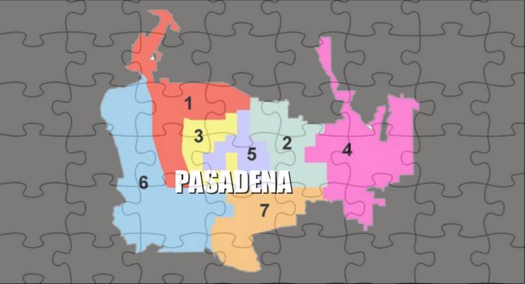
Local residents can now use the city’s redistricting mapping tools with recently released adjusted data to draw City Council district and community of interest maps.
Every 10 years, the city of Pasadena utilizes decennial census data to adjust City Council district boundaries to equalize population among the seven districts in the city. On Aug. 12, the Census Bureau released the official population data for the 2020 Census.
The statewide database implemented adjustments for the state and county prison population as required by state law and released adjusted redistricting data to the public on Sept. 22.
“Beyond ensuring that each district represents about the same number of constituents, redistricting determines how neighborhoods and communities are grouped together for the purposes of electing a City Councilmember,” according to a statement released by the city.
Using public input and submitted maps as a guide, Pasadena’s Redistricting Task Force will work together to recommend a redistricting plan to the City Council for consideration.
The recommended redistricting plan will be drawn in accordance with federal law to ensure equal population in each district and compliance with the Voting Rights Act. Section 2 of the Voting Rights Act prohibits voting practices and procedures, including redistricting plans that discriminate on the basis of race, color or membership in a language minority group.
Residents are encouraged to get involved in the redistricting process by submitting redistricting plans or communities of interest maps using mapping tools found on the city’s dedicated redistricting webpage: www.cityofpasadena.net/
Residents are not required to submit complete maps; they can simply draw boundaries for their own desired district. The Redistricting Task Force meets at 9 a.m. every Saturday morning in October. Members of the public are encouraged to submit redistricting plans prior to each meeting to allow the technical consultants to present each plan to the task force. All legally compliant maps will be posted on the City’s redistricting webpage: www.cityofpasadena.net/
The recommended plan must also comply with state law, including the FAIR MAPS Act, which states districts must be (listed in order of importance):
-
Geographically contiguous (all portions of a council district are connected),
-
Respectful of the geographic integrity of local neighborhoods or communities of interest in a manner that minimizes divisions,
-
Drawn with easily identifiable boundaries that follow natural or artificial barriers (streets, freeways, hills, etc.), and,
-
Drawn to encourage geographic compactness with boundaries and not drawn for purposes of favoring or discriminating against a political party.


 0 comments


